 On March 22, 2014, a rain storm triggered a landslide in Oso, Wash.
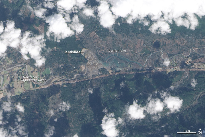 Numerous homes were destroyed in the landslide, which resulted in 24 deaths.
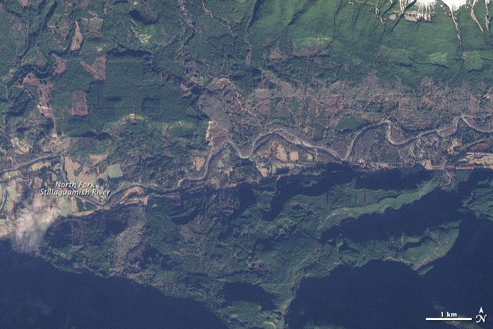
The landslide created a dam that blocked the river, causing a barrier lake to form. The Operational Land Imager (OLI) on Landsat 8 obtained this image of landslide debris and the barrier lake on March 23, 2014. An image of the same area taken on January 18 reveals the damage the landslide caused.
According to a Durham University geologist, the landslide was a reactivation of an earlier landslide that caused problems in 1988 and 2006. A report filed with the U.S. Corp of Engineers in 1999 warned that the hillside had the “potential for a large catastrophic failure.”
Was this article valuable?
Here are more articles you may enjoy.
 Elon Musk Alone Can’t Explain Tesla’s Owner Exodus
  Charges Dropped Against ‘Poster Boy’ Contractor Accused of Insurance Fraud
  These Five Technologies Increase The Risk of Cyber Claims
  Hackers Hit Sensitive Targets in 37 Nations in Spying Plot
Want to stay up to date?
Get the latest insurance news
sent straight to your inbox.