Federal officials say that about 6,500 more properties in Broome Count, New York than originally believed are vulnerable to floods like one that devastated parts of the region in 2006.
Updated flood maps released Thursday by the Federal Emergency Management Agency now show about 11,000 properties could be threatened in the Susquehanna River basin.
One reason for the change: some levees in the county don’t meet current requirements, including one that the top of a levee or flood wall must be three feet above the water during a 100-year flood event.
The draft maps are the product of a three-year study and won’t be finalized for a year. Once they are, property owners will be required to buy flood insurance.
A similar review for Chemung County is due sometime next year.
Was this article valuable?
Here are more articles you may enjoy.
 One out of 10 Cars Sold in Europe Is Now Made by a Chinese Brand
  FM Using AI to Elevate Claims to Deliver More Than Just Cost Savings
  Berkshire Utility Presses Wildfire Appeal With Billions at Stake
 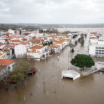 Portugal Rolls Out $2.9 Billion Aid as Deadly Flooding Spreads
Want to stay up to date?
Get the latest insurance news
sent straight to your inbox.