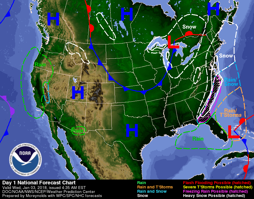
A quick moving low pressure system, dubbed a bomb cyclone, located just off the East Coast of Florida will move northeast toward Canada by Friday, according to a short range forecast by the National Weather Service. According to the National Oceanic and Atmospheric Administration, a bombogenesis, as it is also known occurs “when a midlatitude cyclone rapidly intensifies, dropping at least 24 millibars over 24 hours.”

The storm is expected to produce snow and rain/freezing rain along the Southeast Coast through Wednesday evening. As the storm moves up the Eastern seaboard, snow and rain will develop, changing over to all snow by Thursday morning.
Heavy snow may occur over parts of the Southern Mid-Atlantic Coast overnight Wednesday. Parts of New England will see snow develop and expand into Northern New England by Thursday afternoon continuing into into Friday morning.
The NWS offered the following messages about this East Coast Winter Storm:
1. This winter storm is forecast to bring the potential for a mix of freezing rain/sleet/snow from portions of northern Florida to North Carolina, and snowfall northward along portions of the Mid-Atlantic into northern New England. Blizzard conditions are possible across portions of eastern New England late Thursday.
2. If this winter storm tracks closer to the coast, it could mean more snow while a track farther east could mean less snow.
3. This system has the potential to produce strong, damaging winds possibly resulting in downed trees and/or power outages.
4. Minor to moderate coastal flooding/erosion is possible due to a combination of high tides and wave action, especially Thursday afternoon, January 4.
5. Winter Storm Watches and Warnings are in effect from north central Florida northward through eastern New England.
Was this article valuable?
Here are more articles you may enjoy.

 These Five Technologies Increase The Risk of Cyber Claims
  Canceled FEMA Review Council Vote Leaves Flood Insurance Reforms in Limbo
  UBS Top Executives to Appear at Senate Hearing on Credit Suisse Nazi Accounts
  Charges Dropped Against ‘Poster Boy’ Contractor Accused of Insurance Fraud