A fast-moving winter storm, growing stronger by the hour, has grounded 3,000 flights, delayed rail travelers in the busy Northeast Corridor and closed schools in New York and Boston.
 Manhattan could get as much as 9 inches (23 centimeters) of snow by late Thursday and Boston could see 14 inches, the National Weather Service said. At 7 a.m., the storm was off the Virginia coast and getting stronger by the hour, said Bob Oravec, a senior branch forecaster at the U.S. Weather Prediction Center in College Park, Maryland.
“The storm has deepened a lot,” Oravec said by phone. “It looks pretty progressive, so it is a storm that won’t last long but it will have an impressive impact.”
Winter storm warnings cover parts of 13 eastern states, while blizzard warnings blanket the U.S. coast from North Carolina to Maine, including New Jersey, Long Island and Boston. Governors in several states in the path of the storm have declared emergencies.
More than 67,000 homes and businesses were blacked out as of about 7 a.m. New York time Thursday, according to data from utility websites compiled by Bloomberg. Most were in and around Virginia Beach, Virginia, where Dominion Energy reported about 37,000 customers without power.
As of 8:28 a.m., 3,000 flights around the U.S. were canceled with airports in New York, New Jersey and Boston hardest hit, according to FlightAware, a Houston-based airline tracking service. Amtrak had cut back on train service between Boston and New York, according to a statement.
The Long Island Rail Road was reporting delays on some commuter lines and the Massachusetts Bay Transportation Authority canceled ferry service in Boston Harbor and is running commuter trains on a reduced schedule. New York’s Metropolitan Transit Authority reported delays and service changes on some subway lines. Bus service to and from the Port Authority Bus Terminal may be delayed up to 30 minutes, New Jersey Transit said.
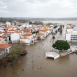
In addition to the snow, coastal areas are at risk for flooding, the weather service said. Tides in New York could run about 18 inches higher than normal, putting parts of Queens and Staten Island particularly at risk until about noon, Faye Morrone, a weather service meteorologist in Upton, New York said.
Tides could run even higher along the Massachusetts coastline just after midday Thursday, the weather service said.
The storm, as predicted, has been getting more powerful, a process called bombogenesis, which means its central pressure drops 24 millibars in 24 hours.
“The pressure has dropped tremendously, 21 millibars in six hours, so it is really going to town off the Mid-Atlantic coast now,” Oravec said.
After the storm moves north, Canada could get heavy snow, high winds and damaging surf from New Brunswick and Nova Scotia, according to Environment Canada. For the U.S., the storm’s exit will mean plunging temperatures from the Great Plains to the East Coast.
“There is a lot of potential for records being broken Friday and Saturday,” said Gregg Gallina, a forecaster with the Weather Prediction Center.
Was this article valuable?
Here are more articles you may enjoy.


 Navigators Can’t Parse ‘Additional Insured’ Policy Wording in Georgia Explosion Case
  One out of 10 Cars Sold in Europe Is Now Made by a Chinese Brand
  Portugal Rolls Out $2.9 Billion Aid as Deadly Flooding Spreads
  Why 2026 Is The Tipping Point for The Evolving Role of AI in Law and Claims