Typhoon Mawar is reported to be nearing Japan’s main island of Honshu. It is currently a category 2 storm with sustained winds of 105 mph (168 kph).
Mawar’s path has been erratic and it’s still unclear whether or not it will actually make landfall in Japan, but authorities have issued storm warnings along the coast.
Mawar’s center is currently around 200 miles (320 kms) southwest of Tokyo and the typhoon is moving north at around 10.6 mph (17 kph). Forecasters have indicated that it could turn further towards the northeast.
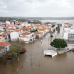
Although the center may not pass directly over Japan, high winds, heavy rains and flooding are predicted along the coast from south of Osaka to the northeast of Tokyo.
Was this article valuable?
Here are more articles you may enjoy.

 Uber Jury Awards $8.5 Million Damages in Sexual Assault Case
  Cape Cod Faces Highest Snow Risk as New Coastal Storm Forms
  Portugal Rolls Out $2.9 Billion Aid as Deadly Flooding Spreads
  Berkshire Utility Presses Wildfire Appeal With Billions at Stake