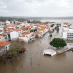
Flooding in the upper Midwest, which could rival the high water levels experienced in 2006 and possibly 1997, and continued drought in the South and West are among the warnings contained in the national outlook for this Spring from federal forecasters at the National Oceanic and Atmospheric Administration (NOAA).
Flooding – Midwest on Watch
A deep snowpack and recent heavy rain have elevated the spring flood threat in parts of the Midwest.
Water released by melting snowpack that is deeper than normal – while running off the already saturated and frozen ground – poses an imminent serious flood threat in the Red River Valley.
Forecasters say flooding will begin this week and that the Red River of the North in Fargo and Grand Forks, N.D., will ultimately reach major flood stage and has a strong likelihood of a crest measuring among the top five highest on record.
Away from rivers, widespread over-land flooding is expected due to the flat terrain and frozen drainage networks in the Red River Basin.
The threat in this area is so great that the National Weather Service created a new category – “High Risk” – to distinguish it from the existing “Above Average” category for flooding potential.
Recent flooding caused by heavy rain from Illinois to Ohio has begun receding, but the now saturated ground is prone to additional flooding with renewed rainfall.
“We are looking at a situation with all the ingredients for near record flooding in the upper Midwest,” said Jack Hayes, director of the National Weather Service. “Sudden snowpack melts due to warm temperatures or a heavy rain could further complicate the flooding on the northern plains.”
Supported by advanced water and weather science and early warnings from NOAA, local officials and emergency managers in the Red River Valley are taking action to prepare their communities, according to Hayes.
River levels – past, current and/or projected – at nearly 4,300 stations across the United States are available through the Advanced Hydrologic Prediction Service at weather.gov/water. The National Weather Service Web site has the latest flood advisories, watches and warnings with localized information.
Temperature and Precipitation – A Waning La Niña
The spring (April through June) temperature and precipitation outlook issued by the Climate Prediction Center – a division of the National Weather Service – indicates warmer-than-normal temperatures from Texas westward to the California deserts north to central Utah with cooler-than-normal temperatures in the Northwest, Hawaii and much of Alaska.
Odds favor below-average precipitation across the northwestern U.S. and South Florida and favor above-average precipitation in Hawaii and northern Alaska.
Elsewhere across the country there are equal chances of above-, near- or below-normal temperatures and precipitation because there is no strong large-scale climate signal to guide long-range forecasts.
Precipitation Outlook
“The current La Niña will likely have some effect on this spring as it continues to weaken. Although La Niña tends to have a smaller influence on U.S. weather during the warmer months, lingering effects are not uncommon in spring,” said Ed O’Lenic, long-range forecaster with the Climate Prediction Center. La Niña – associated with cooler than average sea surface temperatures in the central and eastern equatorial Pacific Ocean – can alter the typical temperature and precipitation patterns across the United States.
Drought Lessening in South, West, but Intensifying in Florida
Texas remains in the bulls-eye of the most widespread and intense drought, followed by California, the Southeast and Wisconsin, but the recent record rain brought much-needed moisture to the Lone Star state, according to recent updates to the weekly U.S. Drought Monitor.
Storms in February and early March across northern California provided some relief to the drought, but storage in major reservoirs is much below average and spring runoff is forecast to be below average with less than a month left in the wet season.
High resolution (Credit: NOAA)
The Climate Prediction Center’s newly updated Seasonal Drought Outlook highlights these areas of drought as generally persisting through June with limited areas of improvement. Though with continued dryness, drought may develop from northern Virginia to New Jersey.
Underscoring the severity of the Texas drought, the state just emerged from its driest winter since records began in 1895. Even with the recent rain, cumulative rainfall during the past six months remains as much as a foot below normal in parts of Texas and Oklahoma. Therefore, severe drought has not ended and is expected to linger well into spring. Severe drought has been increasing in Florida, where some cities had their driest winter on record, and where an increasing risk of wildfires has developed. The Florida drought is likely to persist and intensify until the thunderstorm season gets underway in late May and June.
Tornado Season
Spring is also the season for tornadoes as April, May and June are, on average, the busiest months for twisters. Though the severity of this year’s tornado season is influenced by short-term weather patterns that are only predictable out to a week in the future, NOAA says it is imperative to know when the atmosphere is ripe for severe thunderstorms to produce tornadoes.
Hayes urged citizens to get a NOAA Weather Radio as one way to get warnings from the National Weather Service.
Was this article valuable?
Here are more articles you may enjoy.

 Uber Jury Awards $8.5 Million Damages in Sexual Assault Case
  UBS Top Executives to Appear at Senate Hearing on Credit Suisse Nazi Accounts
  China Bans Hidden Car Door Handles in World-First Safety Policy
  Portugal Rolls Out $2.9 Billion Aid as Deadly Flooding Spreads