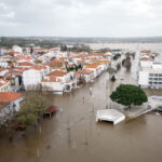
In case Superstorm Sandy did not convince risk experts that hurricane categories are not useful predictors of potential storm surge levels, a NOAA executive hammered home the point at a recent insurance conference.
“We recently have stopped attaching storm surge to the Saffir-Simpson scale” for hurricanes, said Edward Johnson, director of strategic planning and policy for the National Weather Service division of the National Oceanic and Atmospheric Administration, during a session of the Extreme Weather Insurance Risk Management Conference in New York City last week.
Calling out a modeling firm for what he said was an incorrect summary of the hurricane-intensity scale displayed on a handout included in the conference materials, Johnson said storm surge is not highly correlated with the central pressure of the hurricane. The document in question showed the Saffir-Simpson the categories 1 through 5 along with corresponding wind speeds, central pressure ranges and storm surge levels for each one.
According to Johnson, storm surge is affected by a lot of other things, such as the total size of a storm and its direction. “There are Cat 3 storms with much more damaging storm surge than a Cat 4 storm that comes from a different direction, or that’s smaller in total diameter.”
“So rather than mislead people, we want to sever that connection to storm surge. We want to be much more precise about the storm surge element of these coastal storms.”
While the conference handout associated 13-18 foot storm surge with a Saffir-Simpson Category 4 storm, other experts speaking at the conference noted that Sandy—a Category 1—had nearly 14 feet surge levels in Battery Park in lower Manhattan.
Johnson noted that the other two elements describing the Saffir-Simpson—central pressure and wind—are very well correlated, especially out in the ocean.
“We are looking actively at how we describe this hazard,” he said, referring to storm surge, which he said is a very complex phenomenon that is difficult to communicate. “It has a lot of elements, and we think we’ve described it poorly frankly.”
A slide he presented during his talk revealed that NWS is considering the pros and cons of issuing warnings specific to storm surge in addition to flood and hurricane watches and warnings.
Johnson remarks on storm surge came after he provided some background about NOAA NWS’ recently developed strategic plan, noting that a large part of the plan involves better communication with other scientists and the public.
NOAA NWS’ mission is “building a weather-ready nation,” he said, characterizing this as “a thoughtful rejection of a plan that looks inward.”
Rather than setting a goal of becoming the best weather service in the world, the “weather-ready nation” mission is “a real attempt to describe what we think the country needs—which is to build a society that is much more resilient to weather.”
“To achieve our mission, NWS understands that it must become one of the most adept institutions in the world at working with others,” Johnson said,
He continued: “One of the threads in our planning is that we have to spend a lot more time and energy to invoke and involve a broader range of sciences—especially social sciences—to focus in on how we communicate with people and on how people understand the hazards that we have.”
For the remainder of the session, Johnson discussed provision of the Biggert-Waters Flood Insurance Reform law, requiring NOAA to sort out wind from water damage for slab claims—a requirement that he indicated presents a major challenge for the federal weather agency.
Was this article valuable?
Here are more articles you may enjoy.

 Charges Dropped Against ‘Poster Boy’ Contractor Accused of Insurance Fraud
  UBS Top Executives to Appear at Senate Hearing on Credit Suisse Nazi Accounts
  US Will Test Infant Formula to See If Botulism Is Wider Risk
  Portugal Rolls Out $2.9 Billion Aid as Deadly Flooding Spreads