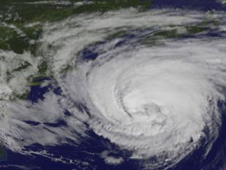
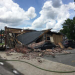
A Sandia National Laboratories team is gearing up for hurricane season, readying analyses to help people in the eye of a storm.

The Department of Homeland Security’s National Infrastructure Simulation and Analysis Center (NISAC), jointly housed at Sandia and Los Alamos national laboratories, studies how hurricanes and other disasters disrupt critical infrastructure, such as roads, electricity and water systems.
Hurricane season began June 1 and runs through Nov. 30. It generally peaks in August and September, notwithstanding Superstorm Sandy’s appearance late last October.
With the onset of hurricane season, NISAC has two jobs: conducting annual “hurricane swath” analyses of probable impacts on the Gulf Coast and East Coast and providing quick analyses of crisis response in the face of an imminent hurricane threat to the United States.
Analyses Allow Preliminary Look at Storm
A swath analysis looks at how a hurricane might interrupt critical services and at impacts to infrastructure specific to an area, such as petroleum and petrochemical industries in Houston or financial services in New York City. It also looks at such things as the economic impact of the storm or how it could upset food deliveries.
Federal officials pull swath analyses off the shelf when a hurricane seems likely to hit a particular place. They used the New Orleans report a few days before Hurricane Isaac headed toward that city last August.
“While it was too far out for us to do our analysis, they could use the report as a first cut,” said Dan Pless, NISAC program lead at Sandia.
NISAC’s portfolio includes a dozen swath analyses updated every few years, two cities at a time. A team coordinated by Mark Pepple, NISAC fast response lead, this year updated reports for Houston and Corpus Christi, Texas; last year the work focused on Miami and Tampa. Updates keep information from becoming too stale, Pless said.
NISAC came up with the original analyses, but is working on updates with state and local officials and Department of Homeland Security (DHS) agencies, including the Federal Emergency Management Agency (FEMA).
Reports Analyze ‘Reasonable Bad Scenario’
Each report uses a “reasonable bad scenario” that would be possible in the particular area, with local officials deciding what scenario would be most useful for disaster planning, said Pless and Pepple. For example, a Category 5 hurricane isn’t likely in New York City because colder waters dampen hurricane strength, but a Category 3 is within reason.
“These storms form in the Caribbean, they form in the Gulf. They can get quite strong down there,” Pless said. “They don’t form in the North Atlantic. They have to travel there.”
The analyses — also useful in other natural disasters — consider impacts to the infrastructure, the population and the economy, Pless said.
“We look at where power outages are likely,” he said. “For Houston, it would examine the possible national impact on petroleum supplies and whether we should worry about that.”
They look at so-called food deserts: urban areas where food delivery might be interrupted, he said.
NISAC also has found that some local officials want more demographic information. Officials in Florida, with its high retiree population, want to know where the elderly are concentrated, Pless said.
The most difficult part of an analysis is defining a scenario because every place is different and a wide range of agencies must reach consensus, he said.
Team Activated for Big Hurricanes
Once NISAC is activated, the team focuses on exactly what’s in the storm’s projected path.
“Anytime a hurricane is going to make landfall in the U.S. we’re busy at some level. If it’s going to be a Category 3 or higher, you can pretty much figure we’re going to go to full activation,” Pless said. The decision whether to activate and to what degree comes from NISAC’s program manager at the DHS.
Pepple helps lead NISAC’s crisis response. When federal officials activate a team, he coordinates with DHS and Sandia’s partners at Los Alamos, which has its own team doing analyses. The labs collaborate. For example, Los Alamos models and analyzes the impacts to electricity and metropolitan water systems, and Sandia uses those results to look at impacts to energy such as petroleum and natural gas or sectors such as transportation and banking.
He’s also responsible for getting Sandia’s team together, not just pulling in people, but identifying what expertise or simulation tools are needed. While a crisis response team always needs at least one economist to assess economic impact, a hurricane in Houston would require more analyses of the petrochemical sector than a hurricane in North Carolina, where agriculture could be a larger concern.
NISAC and DHS collaborate on how much time the team has before it locks in a prediction of the hurricane’s track toward land. The National Oceanic and Atmospheric Administration issues regular landfall projections. At some point, NISAC has to lock in a storm track, or prediction, on which to base analyses.
The amount of time for analysis is shrinking, Pless said. NISAC had 48 hours for Hurricane Gustav, which hit the South in late August and early September 2008.
“They said that’s too much time, the track can change too much in that time,” Pless said.
The team had 24 hours to do its analysis for Hurricane Ike, which hit the Texas, Louisiana and Mississippi coasts in September 2008. By the time Irene hit the East Coast in August 2011, the deadline had dropped to 12 hours. “We’re roughly around 10 to 11 hours at this point,” Pless said.
The team provides similar information as for a swath analysis, with less detail but using the hurricane’s strength and what’s in its path. Sometimes the team adds a caveat that damage could be worse if the storm changes path.
Questions Spike When Hurricane Hits
The team also responds to a flurry of questions from DHS just before landfall. For Ike, Pless said, officials wanted to know which large Houston-area water treatment plants were most likely to lose power and would need one of three available FEMA generators.
For Sandy, NISAC’s report identified subways in the storm surge zone and did some power outage modeling. NISAC’s analyses complement those done by the Department of Energy or other agencies by providing unique evaluations of how damage to one type of infrastructure, such as power lines, would impact other infrastructures. As the designated sector-specific agency for the energy infrastructure sector, DOE’s Office of Electricity Delivery and Energy Reliability helps prepare for and respond to energy-related emergencies like Hurricane Sandy.
Questions to the team usually spike after a hurricane hits. That was particularly true for Sandy.
“You had this massive power outage and they were wondering, ‘OK, we have these cell towers and a lot of them have diesel generators for backup. Those last 48 to 72 hours and the power isn’t coming back in 48 to 72 hours. How do we prioritize that? Few of the gas stations have fuel, what’s going on? Is it that they don’t have power or because eight of the nine fuel delivery terminals in New Jersey were down?’” Pless recalled.
Sandy reversed the normal workload. “Usually we have a lot heavier workload going into the hurricane before landfall and generally have tired people and a lighter workload afterward. On Sandy, we worked the opposite. We had a relatively light workload going in and then it got really busy,” Pless said. “That was because it was that weird perfect storm.”
Source: Sandia National Laboratories
Was this article valuable?
Here are more articles you may enjoy.

 UBS Top Executives to Appear at Senate Hearing on Credit Suisse Nazi Accounts
  Tesla Sued Over Crash That Trapped, Killed Massachusetts Driver
  Navigators Can’t Parse ‘Additional Insured’ Policy Wording in Georgia Explosion Case
  Canceled FEMA Review Council Vote Leaves Flood Insurance Reforms in Limbo