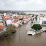
While hurricane activity for the Atlantic Basin is projected to be below average for the 2015 season, impactful landfalls can occur in any hurricane season even those of reduced activity, according to Guy Carpenter & Company, LLC, a global risk and reinsurance specialist and a wholly owned subsidiary of Marsh & McLennan Companies.
2015 Hurricane Season Outlook
For the North Atlantic Basin, seasonal outlook providers are expecting tropical activity to fall below the long-term average of 1955-2014. The enduring El Niño conditions and cool sea-surface temperatures expected in the Atlantic Main Development Region, which encompasses the area of the tropical Atlantic between Africa and the Gulf of Mexico, are indicative factors of reduced basin activity. However, the relationship between basin activity and landfalls is volatile and a quiet season does not guarantee safety from a catastrophic hurricane landfall.
Historical Impacts & Context
As outlined in the briefing, El Niño conditions do tend to suppress hurricane development in the Atlantic Basin, but scientific research reveals that this effect is strongest in the deep tropics. In fact, the 1957 and 1965 seasons were both moderate El Niño years, but each witnessed the landfall of a major hurricane. The 1957 season experienced only three hurricanes in the Atlantic Basin, but realized significant damages during the landfall of Hurricane Audrey, a Category 4 storm that struck the Texas-Louisiana border. Similarly, the 1965 season produced just four hurricanes but included Hurricane Betsy, a Category 4 storm that made US landfall on the northern Gulf and caused significant economic losses.
“Seasonal activity predictions are valuable, but regardless of whether a particular season is expected to be quiet or active, historical experience reminds us that the impact of even a single tropical storm or hurricane landfall can be severe,” said David Lightfoot, head of GC Analytics – Americas. “Tropical Storms Ana and Bill are timely reminders of the importance of hurricane planning and preparation, even during an expectedly quiet season.”
Meteorological Indicators
The El Niño Southern Oscillation (ENSO) phenomenon is signaled by sea-surface temperatures in the tropical East Pacific, with warm El Niño phases and cold La Niña phases. The large-scale circulations associated with El Niño enhance wind shear, or changing wind speed with height, in the tropical Atlantic region. The enhanced wind shear in turn disrupts tropical cyclone development, generally resulting in fewer tropical cyclones in the Atlantic basin. According to the National Oceanic and Atmospheric Administration’s Climate Prediction Center, El Niño conditions are currently in place and there is a 90 percent chance of these conditions continuing through the season. Historically, there is an approximate 10-20 percent reduction in U.S. landfalls during El Niño seasons.
Additionally, seasonal outlook providers note that cooler than average sea-surface temperatures seen in the tropical Atlantic region are an indication of a quiet season ahead. However, above normal sea-surface temperatures are seen in an area adjacent to the US Florida coast, including the Bahamas and northern Caribbean. The variability and subtleties of sea-surface temperature, U.S. landfalls, and even the strength and placement of El Niño warrants a preference for a standard or “long-term” view of hurricane landfalls, to account for this variability with greater confidence.
“While this indeed may be a quiet year, the northern Gulf of Mexico and northern Caribbean areas will require close monitoring,” said James Waller, PhD, Research Meteorologist for GC Analytics. “A single landfalling tropical storm or hurricane can produce wind, surge and inland flood impacts, the severity of which can vary greatly from event to event.”
Source: Guy Carpenter, LLC
Was this article valuable?
Here are more articles you may enjoy.

 One out of 10 Cars Sold in Europe Is Now Made by a Chinese Brand
  UBS Top Executives to Appear at Senate Hearing on Credit Suisse Nazi Accounts
  Portugal Rolls Out $2.9 Billion Aid as Deadly Flooding Spreads
  These Five Technologies Increase The Risk of Cyber Claims