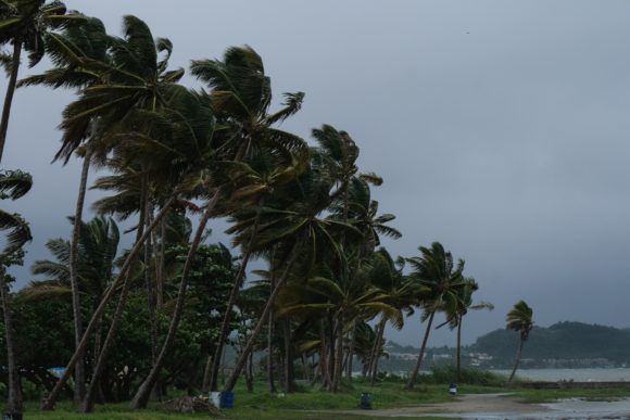
CABO SAN LUCAS, Mexico — Hurricane Genevieve lost some of its punch Thursday even as it lashed Mexico’s Los Cabos tourist resorts with hurricane-force gusts and heavy rains. And two storms formed in the Atlantic Basin — both on potential tracks toward the United States.
Tropical Storm Laura formed in the Atlantic west of the northern Leeward Islands on a track that would take it into the Gulf of Mexico with possible landfall in Florida, Alabama, Mississippi or Louisiana. Also, a tropical depression gained strength in the Caribbean off the coast of Honduras and was on northwest track that could bring two tropical storms in the Gulf at the same time.
Genevieve had a been a powerful Category 4 hurricane with winds of 130 mph (215 kph) on Tuesday, but weakened to Category 1 strength as it pushed past the Los Cabos region, the U.S. National Hurricane Center said. On Friday morning, the storm continued to move north along the Baja Coast with top wind of 45 mph.
The center said the hurricane was expected to stay out in the Pacific while moving northwestward along the Baja coast and weakening Thursday and Friday. But it was raking the shore with powerful winds and up to 4 to 8 inches (10 to 20 centimeters) of rain, creating the potential for dangerous flooding.
High surf had already claimed two lives in the area. Police in Cabo San Lucas said a 15-year-girl was trapped by a large wave and an adult tried to save her Tuesday. Both died.
The hurricane center said Genevieve had maximum sustained winds of 75 mph (120 kph) Thursday morning and it was centered about 100 miles (160 kilometers) west-northwest of the southern tip of the Baja peninsula. It was moving to the northwest at 12 mph (19 kph).
Civil defense officials in Los Cabos said more than 100 people had gone to shelters, where distancing measures were in place due to COVID-19. Baja California Sur state officials said 15,000 foreign tourists were in the state, most in the Los Cabos region, which earlier had almost been emptied of visitors by pandemic restrictions.
Meanwhile, two new tropical depressions formed Thursday in the Atlantic Basin, and tropical storm watches were posted for several Caribbean islands and parts of Honduras.
The Hurricane Center said Laura became a tropical storm on Friday morning. It was expected to skirt the Leeward Islands, Puerto Rico, the Dominican Republic and Cuba. The early, still uncertain track showed it potentially reaching Florida by Monday as a hurricane. Maximum winds were 45 mph on Friday morning and slow strengthening was expected over the next 48 hours.
New Tropical Depression 14 was forecast to graze the Atlantic coast of Honduras, then curve across Mexico’s Yucatan Peninsula and potentially head for Texas as a tropical storm by next week, though the track and force that far out remained highly uncertain. Maximum winds were at 35 mph and the storm was expected to be near hurricane strength by the time it reaches the Yucatan Peninsula on Saturday night.
Was this article valuable?
Here are more articles you may enjoy.


 Why 2026 Is The Tipping Point for The Evolving Role of AI in Law and Claims
  Uber Jury Awards $8.5 Million Damages in Sexual Assault Case
  Founder of Auto Parts Maker Charged With Fraud That Wiped Out Billions
  FM Using AI to Elevate Claims to Deliver More Than Just Cost Savings