The El Niño weather pattern was likely to form during the May-July season, with a more than 90% chance of the phenomenon persisting into the North Hemisphere winter, a U.S. government weather forecaster said on Thursday.
A transition from neutral conditions could occur in the next couple of months, the National Weather Service’s Climate Prediction Center (CPC) said.
The El Niño phenomenon is a warming of ocean surface temperatures in the eastern and central Pacific, sometimes causing crop damage, flash floods or fires.
The World Meteorological Organization earlier in May said the weather pattern could contribute to rising global temperatures.
“In regards to this event, there are indications that it will be strong and occur mid-season. This would imply perhaps the monsoon starts on time but with subpar seasonal rainfall,” said Brian Morris, Agricultural Meteorologist (Asia) with the U.S. Department of Agriculture (USDA).
While at least a weak El Niño is likely, the range of possibilities at the end of the year (November-January) include an 80% chance of at least a moderate El Niño, to a 55% (approximate) chance of a strong El Niño,” the CPC said.
Australia could see a drier and warmer start to winter after three years of wet and unpredictable weather, while India, the world’s second-biggest producer of wheat, rice and sugar, could get below-average rains due to the phenomenon.
Sea temperature changes, like the Indian Ocean Dipole – also known as the Indian Niño – could be positive, mitigating the impact of El Niño in India and enhancing them in Southeast Asia, Morris said.
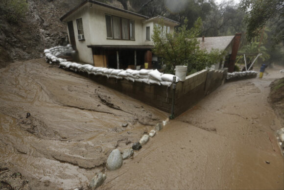
Top photo: In this Jan. 6, 2016 file photo, mud flow skirts a house protected with sandbags in Monrovia, Calif. The National Oceanic and Atmospheric Administration announced in February 2019 that El Nino formed in the central Pacific, but forecasters don’t expect it to last more than three or four months. (AP Photo/Damian Dovarganes, file)
Was this article valuable?
Here are more articles you may enjoy.


 UBS Top Executives to Appear at Senate Hearing on Credit Suisse Nazi Accounts
  Canceled FEMA Review Council Vote Leaves Flood Insurance Reforms in Limbo
  Tesla Sued Over Crash That Trapped, Killed Massachusetts Driver
  Portugal Rolls Out $2.9 Billion Aid as Deadly Flooding Spreads