Insurers’ losses from Hurricane Beryl will be “low and readily absorbed” and the storm is not expected to change pricing conditions in the P&C and reinsurance sectors, Moody’s Ratings said.
Beryl made landfall along the Texas coast as a category 1 hurricane, bringing strong winds and storm surge to much of the Texas Gulf Coast. Parts of east central Texas received 10 to 15 inches of rainfall.
Catastrophe modeling company Karen Clark & Co. said on Thursday that insurers may take a hit of about $2.7 billion from damage caused by the storm.
Core Logic estimated insured wind losses in Texas of between $2.5 and $3.5 billion. The estimated losses include damage to residential, commercial, industrial, and agricultural properties, including damage to contents and business interruption, CoreLogic said. The estimate includes demand surge.
Related: Damage From Hurricane Beryl May Cost Insurers $2.7B in U.S., Modeler Says
Most Texas homeowners have deductibles between 1% and 5%. A shift towards the purchase of a higher deductible amount could significantly reduce the losses paid by insurers, CoreLogic said.
Over 31,000 commercial real estate properties in Texas were expected to be exposed to winds of at least 50 mph, according to Natalie Ambrosio Preudhomme, associate director-commercial real estate, Moody’s. The cumulative estimated value of those properties is over $160 billion.
“This demonstrates that while major damage to many assets is likely to be minimal, it is also likely that thousands of properties face minor repairs, some of which may not be severe enough to meet their insurance deductibles,” said Preudhomme.
Beryl is the earliest category 5 Atlantic hurricane on record. The storm battered the Grenadines on July 1 before passing Jamaica on July 5.
Related: CSU Research Team Increases Atlantic Hurricane Forecast
The storm caused caused minimal damage to central Yucatan Peninsula as a landfalling category 2 hurricane. Beryl then emerged into the Gulf of Mexico and regained hurricane status just before landfall at Matagorda, Texas on Monday morning.
As Beryl progressed northward, the storm tracked directly over Harris County, home to 4.7 million residents. Only five hurricanes since 1960 have tracked within 30 miles of the county seat of Houston, according to Guy Carpenter, a global risk and reinsurance specialist.
Remnants of Beryl spawned tornadoes and flooding from Louisiana up through the Great Lakes and Northeast regions. Shreveport, Louisiana reported a one-day record 67 tornado warnings on July 8.
At least 28 tornadoes spanned from Texas to the Northeastern U.S. have been confirmed by the National Weather Service. The most severe tornado observed was an EF-3 tornado that hit Mount Vernon, Indiana.
“To the east of Beryl’s inland progression, an environment conducive to tornadic development was in place; high levels of atmospheric instability promoted ongoing severe thunderstorm development and shifting winds with height helped to induce rotation within these storms,” Guy Carpenter said in a post event summary.
Active season ahead
Beryl is the first major hurricane of what forecasters expect to be “extremely active” Atlantic Hurricane season. The presence of unusually warm water is a major intensifier of hurricanes and likely contributed to Beryl’s strengthening into a Category 5 storm.
“As seen from pre-season forecasts, oceanic conditions in the North Atlantic were primed for storm activity,” said Sarah Hartley, Director-Moody’s RMS Event Response. “With both sea surface temperatures (SSTs) and oceanic heat content at or near record levels across much of the tropical North Atlantic and Caribbean Sea, these environmental conditions were favorable for Beryl’s development.”
In the aftermath of Beryl, researchers at Colorado State University updated their forecast for the Atlantic Hurricane Season, now calling for 25 named storms, 12 hurricanes and 6 major hurricanes of Category 3 strength or more. The group’s forecast of 6 major hurricanes is double its original projection in April.
The next few weeks are expected to bring a more unfavorable period for tropical cyclone development in the Atlantic, Guy Carpenter said, with the storm season ready to pick back up in early August.
The current El Niño phase is expected to transition to a La Niña phase later this summer, which tends to create more favorable conditions for hurricanes to develop, Moody’s said in a post-storm comment.
While insurers largely escaped Beryl intact, the “aggregation of all events in an active hurricane season could lead to significant losses for P&C insurers,” Moody’s said.
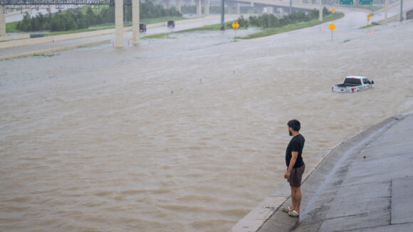
Top photo: A person looks out towards the flooded interstate after Hurricane Beryl swept through the area on July 08, 2024 in Houston, Texas.
Was this article valuable?
Here are more articles you may enjoy.
 Founder of Auto Parts Maker Charged With Fraud That Wiped Out Billions
  Canceled FEMA Review Council Vote Leaves Flood Insurance Reforms in Limbo
  China Bans Hidden Car Door Handles in World-First Safety Policy
  Charges Dropped Against ‘Poster Boy’ Contractor Accused of Insurance Fraud
Want to stay up to date?
Get the latest insurance news
sent straight to your inbox.