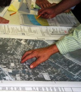
New federal flood insurance rate maps will go into effect today, affecting thousands of Livingston Parish, La., homeowners.

The Advocate reports many people whose homes have never flooded will be required by their mortgage companies to buy insurance that could cost more than $1,000 a year.
Meanwhile, others who have long been required to purchase flood insurance may no longer be required to do so, according to the Federal Emergency Management Agency.
Parish President Layton Ricks questioned the accuracy of the new maps, which he said may force many people to buy insurance unnecessarily.
Ricks estimated several thousand structures have been moved into flood hazard areas under the new maps, adding that a lower number have been moved out.
Walker Mayor Bobby Font said his city was hit hard by the new maps.
About half of the 2,200 or so homes in Walker were either moved into or out of flood-hazard areas.
It appears “more were affected negatively than positively,” he said.
Despite doubts about the validity of the new maps, Font said, the city had no choice but to approve them. “It’s something we feel like is being forced on us.”
If the city hadn’t accepted the maps, he said, none of the city’s residents would have been eligible to purchase federal flood insurance.
Ricks made a similar comment about the parish’s acceptance of the maps.
“FEMA says you have a choice, but if you don’t approve them, then you don’t qualify for federal disaster relief” the next time a storm or other catastrophe occurs, the parish president said.
Also, in areas that don’t approve the new maps, people who are in real danger of flooding won’t qualify to purchase federal flood insurance, Ricks said.
The main problem with the new maps, Ricks said, is that flood studies based on old benchmarks – markers that show elevation – have been meshed with maps drawn using new benchmarks.
The new benchmarks are 11 inches to 3 feet higher than the old benchmarks, he said.
Using maps and studies based on different benchmarks creates “a mess,” Ricks said.
Engineer Eddie Aydell, who examined the maps for Denham Springs and the parish, said the parish’s new benchmarks were set using the latest technology and he doesn’t question their accuracy.
The problem, he said, is using them with flood studies based on old benchmarks. New flood studies that correspond to the new benchmarks need to be conducted if the new maps are to give an accurate picture of the flooding potential for a piece of property, Aydell said.
“All they are doing is combining apples and oranges,” he said. “We’ve been begging FEMA” to address the issue.
Was this article valuable?
Here are more articles you may enjoy.

 Portugal Rolls Out $2.9 Billion Aid as Deadly Flooding Spreads
  Navigators Can’t Parse ‘Additional Insured’ Policy Wording in Georgia Explosion Case
  Cape Cod Faces Highest Snow Risk as New Coastal Storm Forms
  FM Using AI to Elevate Claims to Deliver More Than Just Cost Savings