Drones are being put to good use by public agencies in Central Louisiana, and their usage is expected to increase.
Unmanned aerial vehicles, commonly called drones, are being used by agencies to help them do their jobs more efficiently, and they can even help in potential life-or-death situations.
The Rapides Parish Sheriff’s Office uses its drone for “search and rescue on land-based operations,” according to Lt. Tommy Carnline.
The drone has been deployed to help the Sheriff’s Office cover more ground in searches.
“It aided in the location of a man who was lost over on the levee in Rigolette,” Carnline said.
The Sheriff’s Office drone, equipped with a video camera, flew over a large field, about a mile by two miles wide, in the search for the man, he said. Deputies were able to quickly learn the man was not in the field.
“We didn’t have to concentrate time in looking in that field, and we moved on, and we found the subject a little while later,” Carnline said.
As far as he knows, the Sheriff’s Office hasn’t used the drone to search for marijuana-growing operations, he said, but it could be used for that purpose.
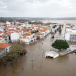
Grant Parish Sheriff Steven McCain said his office has had its drone for several months, and it already proved very useful during recent flooding.
The flooding limited deputies’ movements, “so we put it up in the air and were able to get video and photos in live time. We were concerned about people getting trapped. We could see houses and make sure nobody was on the rooftop and needing help,” McCain said.
The drone was donated to the Grant Sheriff’s Office earlier this year for search-and-rescue purposes by the family of J.W. “Jim” Delaney of Pollock, who went missing in 2012. Delaney was never found despite a massive search effort.
Delaney’s family donated the drone, nicknamed “Jim,” as a way to thank those who searched for him.
Randy Price, an assistant professor for the LSU AgCenter office based in Alexandria, works with eight battery-powered drones used in the Central Louisiana area for agricultural purposes.
“Mainly what they get used for is to look straight down at the crops. We’ll fly fields, like farmers’ fields or research fields – a lot of research fields – where we take imagery that’s straight down, and we’ll put that back together (on a computer), and that shows us where good and bad growing areas are in the fields,” Price said.
He said cameras with special filters can highlight areas where crops are growing well and those where crop conditions are poor.
The AgCenter’s UAVs, as Price refers to them, adhere to the FAA’s commercial rules, including the 400-foot ceiling.
Often used are Phantom 3 drones that weigh about 3 pounds each, have about a mile radius and fly for about 20 minutes per battery charge.
“They’ve got some pretty darn good qualities. We can cover 75 to 100 acres per battery taking imagery straight down. And they have some pretty good apps” that allow for programming automatic flight courses, Price said.
“If you get in trouble and can’t tell which way they’re going or something, you just let go of the sticks (controls), and it’ll actually just coast to a stop and park itself.”
You can then figure out where the drone is via a map system, and you can remotely have it take off again and return to you.
While the Phantom “looks like a spider,” the AgCenter also has Styrofoam, airplane-shaped UAVs with flight times of about an hour.
The drones can be controlled through computer tablets and can also be pre-programmed to fly a specific flight pattern guided by Global Positioning System (GPS).
Price said the AgCenter demonstrates UAVs for farmers to help them determine if owning one would help their operations, but he notes the software needed for crop diagnosis is complicated.
A farmer using a drone would have to have Section 333 approval from the FAA.
Fort Polk uses surveillance drones in training missions, but the unmanned aerial vehicles have not been used for searches or monitoring emergencies so far, a spokesperson said. It is possible they could be used for that “with permission and proper authorizations.”
The state Department of Transportation and Development is not using drones – yet.
“DOTD is investigating the use of drones, but we do not currently have or use drones,” a department spokesman said.
Was this article valuable?
Here are more articles you may enjoy.

 Berkshire Utility Presses Wildfire Appeal With Billions at Stake
  Navigators Can’t Parse ‘Additional Insured’ Policy Wording in Georgia Explosion Case
  One out of 10 Cars Sold in Europe Is Now Made by a Chinese Brand
  Portugal Rolls Out $2.9 Billion Aid as Deadly Flooding Spreads