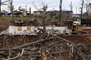
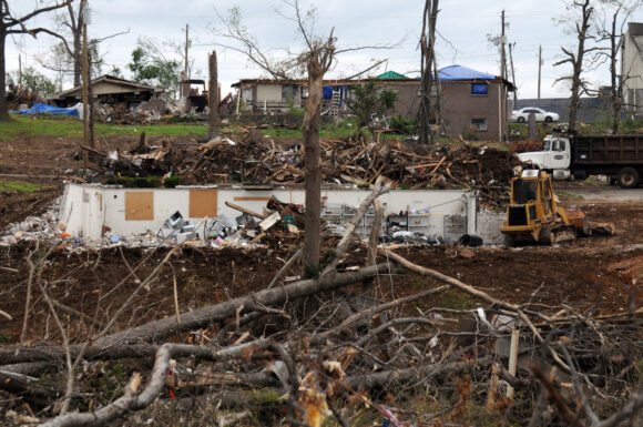
Photos and momentoes that were snatched up and blown hundreds of miles during tornados in the south of the United States two years ago are giving researchers new insight on how debris is carried by the storms and how it could threaten the public.
A new study has documented how one photo traveled nearly 220 miles over Alabama and Tennessee, said John Knox, an associate professor of geography at the University of Georgia who led the research. That is among the longest-documented trajectories of tornado debris.
The slightly scratched snapshot, which shows a stream flowing through a mountainous landscape, traveled from the northwest Alabama town of Phil Campbell to the east Tennessee town of Lenoir City.
The study was recently published online by the Bulletin of the American Meteorological Society.
It tracked the direction the items traveled in relation to the storms that struck Alabama and other Southern states on April 27, 2011.
The researchers analyzed the takeoff and landing points of the items using geography software and mathematical models.
Most debris fell slightly to the left of the storm’s track. But the items that traveled the farthest were found to the right of the path.
Knowing where the debris is likely to fall could help protect the public if a tornado were to strike a hazardous site and suck up toxic biological or radioactive debris, Knox said.
“We need to get enough understanding so we can get fairly reasonable predictions of where the stuff goes,” said John Snow, a professor of meteorology and dean emeritus at the University of Oklahoma who studied tornado debris in the 1990s. Knox’s study builds on research done by Snow and others.
Though nuclear reactors are designed to withstand the force of tornadoes, radioactive materials such as fuel rods are often stored nearby, Snow said. A direct hit on such material is one of many catastrophic scenarios involving tornado-blown debris.

Tornadoes have struck toxic materials in the past. In May 2008, a twister slammed into some of the mountains of mining waste that dot the landscape of Oklahoma’s Tar Creek Superfund site.
Joshua Wurman, an atmospheric scientist who founded the Center for Severe Weather Research in Boulder, Colorado, was not involved in the Georgia research but thinks it could have benefits.
“Let’s say a tornado struck some kind of toxic waste dump. Sure, some of the debris or dust would have some contaminants in that,” Wurman said. “Understanding which direction those contaminants would go could be useful.”
The 934 objects studied by Knox and his students were posted on a Facebook page and later claimed by their owners.
Patty Bullion created the site hours after the tornadoes struck, when several photos and scraps of paper were found in her neighborhood in the northern Alabama town of Lester. She began posting the pictures on her site. Around 2,000 of those photos and documents eventually were claimed by their owners and returned to them. That gave the researchers a gold mine of raw data on which to build.
“I was very thankful that the page could be a help,” Bullion said. “I never dreamed that it would send as many pictures home as it did and then help with research like that. God works in mysterious ways.”
Bullion has since taken down the Facebook site. The items pictured there are highly personal, she said, and she didn’t want them to be on Facebook forever.
The historic 2011 tornado outbreak in the South, combined with Bullion’s social media effort, represented a unique opportunity for the new study, Knox said.
On April 27, 2011, more than 120 tornadoes caused more than 300 deaths across the South.
The items studied from the 2011 outbreak represent “just a small cross section of debris that just carpeted the Southeast,” said Knox. “What was amazing was that there was so much debris that went so far.”
An earlier study on tornado debris by Snow and his colleagues identified only two objects that had traveled about 134 miles (215 kilometers). By contrast, the Georgia study identified 44 items that traveled a comparable distance or farther.
The nearly 220 miles covered by the landscape photo sucked up by one of the Alabama tornadoes rivals the path taken by a canceled check from Stockton, Kansas, which was struck by a tornado in 1991. The check was carried 223 miles (359 kilometers) from Kansas to a farm near Winnetoon, Nebraska, according to records from the World Meteorological Organization.
Knox said the response from his students, who became co-authors of the research paper, was phenomenal.
Knox said he sought to teach them how to conduct the research in a way that was ethical and sensitive to the victims since the tornadoes destroyed lives and homes.
“Hopefully that’s a message that the students will take with them,” he said. “In this case, we had people whose houses were destroyed and the family members killed and the only thing they may have gotten back was a picture of Grandma and Grandpa that went 150 miles into another state.”
Was this article valuable?
Here are more articles you may enjoy.


 China Bans Hidden Car Door Handles in World-First Safety Policy
  Why 2026 Is The Tipping Point for The Evolving Role of AI in Law and Claims
  Uber Jury Awards $8.5 Million Damages in Sexual Assault Case
  Credit Suisse Nazi Probe Reveals Fresh SS Ties, Senator Says