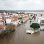
Recognizing October as “Flood Awareness Month,” King County (Washington) Executive Ron Sims is urging residents living in flood-prone areas to prepare for the possibility of rising rivers and streams with a personal flood-preparedness plan.
Because King County hasn’t experienced devastating floodwaters in several years, Sims said residents should guard against complacency.
“We’ve been fortunate in recent years, but people need to remember that we’ve had six federally-declared flood disasters in our county in the last 14 years,” Sims said.
Sims said residents should gather, or update, emergency supplies including: a portable radio, flashlight, fresh batteries, emergency cooking equipment, non-perishable food, drinking water, essential medications and a first aid kit. In some cases, purchasing sand and sandbags can help to protect property.
“We know the rain is coming, so now is the time to think about keeping your family safe,” he said. “People in flood prone areas should prepare their families – make sure they know emergency phone numbers, identify the safest evacuation routes and establish a meeting place in case family members are separated by rising water.”
Floods in King County usually occur between November and February during heavy rain and rapid snowmelt, but it’s not uncommon to have some flooding in October. The Snoqualmie, South Fork Skykomish, Tolt, Raging, Cedar, Green and White rivers all reportedly have a history of flooding during winter months, as do many of King County’s urban streams.
Just recently, King County celebrated with the City of Snoqualmie and the U.S. Army Corps of Engineers the completion of a multi-million dollar Snoqualmie River-widening project designed to reduce the threat of devastating floodwaters. Widening of the river above Snoqualmie Falls is expected to improve water conveyance through what amounted to a pair of bottlenecks that held up water and contributed to the flooding of hundreds of home and businesses in and around the City of Snoqualmie.
In addition, King County is readying for the flood season through participation in the Regional Disaster Plan – a system that allows agencies and businesses to coordinate their response to emergencies – and the Regional Public Information Network (RPIN) public information online news service at www.GOVLINK.org. The service offers more than 50 participating agencies and organizations in the central Puget Sound teaming up to notify the public directly via e-mail or pager when responding to a broad range of service disruptions or emergencies.
The King County Department of Natural Resources and Parks and Department of Transportation Roads Services Division are also joining forces this month to review flood warning procedures and response plans with city, fire, police and roads employees at annual flood awareness meetings in the Cedar, Snoqualmie, Green and White river basins.
King County employees who provide flood warning services are also conducting hands-on training in the field and at the Flood Warning Center this month to update internal procedures and ensure flood warning response services are ready.
When river levels reach a certain threshold, King County’s Flood Warning Center is opened and staffed around-the-clock to monitor river gauges, weather data, dam operations and road closures. King County staff mobilize and begin to gather, analyze and distribute flood warning information so that residents, businesses, property owners and emergency response officials can make important health and safety decisions. In most locations, the flood warning system provides at least two hours warning before floodwaters reach damaging levels.
The Flood Warning Center dispatches staff to patrol the river systems and check levees for damage or indications of weakness. Flood patrols also respond to concerns and emergencies phoned in by property owners.
Flood Warning Center employees work closely with National Weather Service, U.S. Army Corps of Engineers, the City of Seattle and the King County Office of Emergency Management and Roads Services Division to obtain up-to-date information on flooding conditions, problem sites and the need for other emergency services.
Was this article valuable?
Here are more articles you may enjoy.

 Portugal Rolls Out $2.9 Billion Aid as Deadly Flooding Spreads
  Cape Cod Faces Highest Snow Risk as New Coastal Storm Forms
  FM Using AI to Elevate Claims to Deliver More Than Just Cost Savings
  Berkshire Utility Presses Wildfire Appeal With Billions at Stake