Five California harbors are preparing for future tsunamis under a new state project that arms them with maps that identify potential problem areas.
Officials with the California Geological Survey said Friday the participating harbors include San Diego, Los Angeles/Long Beach, Ventura, Santa Cruz and Crescent City. There are also plans to expand the mapping to the more than 100 marinas and harbors.
The maps take into account tsunamis of different strengths and sources, allowing harbor managers to draw up emergency plans to get vessels to safety.
Next week is the 50th anniversary of the 1964 Alaska earthquake. A magnitude-9.2 quake in Alaska triggered tsunami waves that killed 12 people in Northern California.
Was this article valuable?
Here are more articles you may enjoy.
 Elon Musk Alone Can’t Explain Tesla’s Owner Exodus
 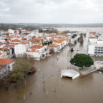 Portugal Rolls Out $2.9 Billion Aid as Deadly Flooding Spreads
  Founder of Auto Parts Maker Charged With Fraud That Wiped Out Billions
  Hackers Hit Sensitive Targets in 37 Nations in Spying Plot
Want to stay up to date?
Get the latest insurance news
sent straight to your inbox.