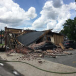
Electric clocks on walls in Anchorage shut down at 5:36 p.m. on March 27, 1964. Time stopped at the start of the ’64 Great Alaska Earthquake, the second largest ever recorded at magnitude 9.2.
The ground shook for four to five minutes, roughly twice through “I Want to Hold Your Hand,” the Beatles No. 1 song that year. With the U.S. and the USSR facing off in the Cold War, some thought the Russians had attacked. The quake produced a tsunami that wreaked havoc along the West Coast. Overall damage was estimated at $2.3 billion in 2014 dollars. The quake and tsunamis killed 131 people.
Though now a distant memory, it helped make experts better prepared for future quakes. It played a role in the formation of the West Coast and Alaska Tsunami Warning Center and taught the U.S. Geological Survey what evidence to look for of previous great quakes, such as events in the Cascadia Subduction Zone off Oregon and Washington.
‘A MELANGE OF BROKEN DISHES AND GLASS’
From his vantage point on the 12th floor of an apartment building in Anchorage, geologist William Binkley could feel the light tremor. He later told the USGS that it was then followed by minutes of violent jarring in which the building appeared to sway 10 feet to 12 feet (3 to 3.5 meters) horizontally and 1-2 feet (0.5 meters) vertically.
The sound was a deep rumble followed by shattering plaster and glass. Cabinets and the refrigerator crashed to the kitchen floor. It was “churned into a melange of broken dishes and glass, catsup and syrup, flour, beans, pots and pans, eggs, lettuce and pickles,” Binkley said in a paper reissued recently by the USGS for the anniversary of the quake.
Binkley crawled into a hallway and braced his feet against one wall and his back against another until the shaking stopped.
Landslides caused most of the damage in Anchorage, about 75 miles (120 kilometers) from the epicenter. Sections of the city, including a 14-block stretch in the shape of an oval near the city’s main street, slid. Buildings were damaged, including some that fell into a trench created by the ground subsiding. Nine people died in the city.
THEY CALL THEM MEGATHRUSTS
Geologists have a name for such strong earthquakes – megathrusts.
Plate tectonic theory says the Earth’s crust is made up of about a dozen major plates that rest on hot mantle. The thin, dense, Pacific Plate at Alaska’s southern edge moves at a shallow angle beneath the North American Plate at average rate of 2.3 inches (5.8 centimeters) per year and eventually is reabsorbed by mantle. Strain builds up until there’s a slip.
The Moment Magnitude scale rates quakes by the energy they release by calculating the area of fault rupture, the average amount of slip, and the force required to overcome the friction sticking the rocks together, according to the USGS. Every whole number higher on the scale represents 30 times the energy of the previous number.
More energy was released in the 1964 magnitude 9.2 quake than all other recorded Alaska quakes combined, said USGS research geologist Peter Haeussler. And drilling showed evidence of nine such megathrusts in south-central Alaska in 5,500 years. The average time span between them: 600 years.
FAR MORE DEADLY WERE THE OCEAN WAVES
The temblor caused two kinds of waves: local and trans-ocean tsunamis.
Eighty-five of the 106 Alaska tsunami deaths were caused by waves generated by underwater landslides. Rivers flowing into Alaska fjords build up huge deltas of unstable sediment on deep, underwater slopes, said USGS research geologist Rob Witter. Slides generate waves like a rock dropped in a pond.
During local tsunamis, water can at first retreat from shore in response to the underwater slide, then rush back. That’s what happened at Port Valdez. When the water swept back in, it smashed a freighter into the city dock. Longshoremen and children who had assembled to catch oranges or candy tossed down from the crew were killed. Thirty-two people died.
The great quake also rumpled the ocean floor like a rug, creating a trans-ocean tsunami. The deadly waves traveled down the West Coast. Four campers on a beach died at Newport, Ore. A dozen died in the northern California community of Crescent City.
NOW THE WEST COAST HAS TSUNAMI MONITORS
Anchorage had almost no seismic equipment measuring quakes in 1964. The state and the USGS now monitor them through the Advanced National Seismic System, which gathers information to assess hazards, create hazard maps and design buildings.
The quake played a role in the formation of the West Coast and Alaska Tsunami Warning Center, renamed the National Tsunami Warning Center, operated by the National Oceanic and Atmospheric Administration. The center within minutes of a quake can put out alerts to warn susceptible communities along the West Coast and Hawaii that a big wave is headed their way.
The quake raised awareness in Alaska that the only warning of a dangerous local tsunami will be the shaking of the ground itself.
“If you feel shaking and you’re near the shore, you need to get to high ground, really quick,” Witter said.
Was this article valuable?
Here are more articles you may enjoy.

 LA County Told to Pause $4B in Abuse Payouts as DA Probes Fraud Claims
  US Will Test Infant Formula to See If Botulism Is Wider Risk
  Elon Musk Alone Can’t Explain Tesla’s Owner Exodus
  Navigators Can’t Parse ‘Additional Insured’ Policy Wording in Georgia Explosion Case