Climate change is spurring a new, deep dive into a complex, little-studied weather system blamed for creating billions of dollars in flood damage across the western U.S.
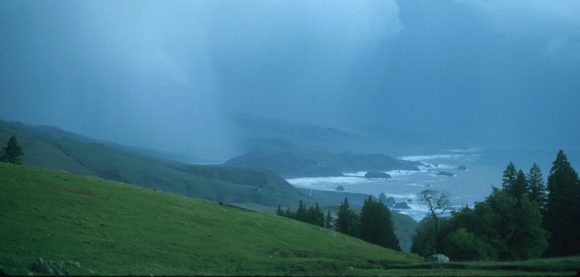
Atmospheric rivers are narrow ribbons of concentrated moisture that originate in the Pacific and can flow thousands of miles before dropping rain and snow on land. Scientists are ramping up their research into the systems this winter fearful that warmer temperatures tied to climate change will boost the moisture they carry, supercharging them moving forward.
“Hurricane hunter” planes are set to fly at least 12 missions directly into the systems, double last year’s number, to gather a wide range of meteorological data. At the same time, 100 new ocean buoys will monitor how the systems form. The goal: Better warning processes to stave off flooding.
“It is 100% completely saturated air,” said Rich Henning, a flight director for the National Oceanic and Atmospheric Administration who conducts onboard weather observations. “If you’re ever wondering how six feet of snow can fall in the Cascades in one day, this is exactly how all that moisture is transported.”
The systems flow between 1,000 and 2,000 feet above the surface, with 80 mile-per-hour winds pushing the water vapor through the air, Henning said. Last week, crews from the National Oceanic and Atmospheric Administration and the U.S. Air Force Reserve flew into an atmospheric river that traveled from Hawaii to the Pacific Northwest.
The NOAA flight took off as the system bore down on their airport near Portland, Oregon, said Lieutenant Commander Ron Moyers, the pilot. The plane was wrestling with turbulence and icing almost as soon as the wheels left the runway, he said.
Once in the air and over water, the NOAA crew dropped about 30 sensors from a height as high as 45,000 feet, the upper end of the Gulfstream IV’s ceiling, Henning said. Slowed in their decent by small parachutes, the sensors—called dropsondes—measure temperature, moisture, wind and air pressure, data that will later be assessed by scientists at NOAA and the Scripps Institution of Oceanography in San Diego.
A study released in December by Scripps and the Army Corps of Engineers found that atmospheric rivers caused 84% of the flood damage suffered in 11 western states over 40 years through 2017. The average annual cost: $1.1 billion, according to the report.
“In a warmer climate,” the study concluded, atmospheric rivers will be “more intense as they become wetter, longer, and wider; there is some indication that this is already happening.”
It won’t take much of a temperature change to boost their moisture content, according to John Dickson, a flood researcher who is the chief executive officer of Aon Edge, a Montana-based flood insurance provider. A rise of just 1.8 degrees Fahrenheit can boost water vapor in the air by 7%, he said.
“Our world continues to change and our land use practices are constantly evolving,” Dickson said., “Yet we rely on risk management tools that are decades old to navigate the current times.”
Besides helping forecasts in the western U.S., the new data will have international significance, since the rivers can originate in oceans worldwide.
“There has been an amazing amount of research on the hurricane problem and tornadoes and nor’easters,” said Marty Ralph, a Scripps scientist. “But it turns out atmospheric rivers are a real issue on the West Coast, and they have not really had that much attention.”
Ralph sees the new research as critical. “One of the fundamental findings on the science of climate change in the West is the increasing likelihood of extremes, both plus and minus,” he said.
The results can’t come soon enough for Curt Aikens, general manager of the Yuba County Water Agency in Marysville, California. California can get half its water from the storms, according to NOAA.
Getting advanced warning on the size of an atmospheric river and where it will hit could let managers make room in reservoirs to absorb an expected deluge, or keep water intact they might have released needlessly, Aikens said. They also can affect snowpak in the mountains, increasing the water flowing into streams and rivers longerterm.
“Twenty years ago I would wait to see the rain hit the ground and see the runoff before the decisions were made,” Aikens said. With the new data, “we can make decisions days ahead of the arrival of the storm.”
Was this article valuable?
Here are more articles you may enjoy.


 Charges Dropped Against ‘Poster Boy’ Contractor Accused of Insurance Fraud
  Hackers Hit Sensitive Targets in 37 Nations in Spying Plot
  Berkshire Utility Presses Wildfire Appeal With Billions at Stake
  Elon Musk Alone Can’t Explain Tesla’s Owner Exodus