Geospatial Intelligence Center News

Business News: Carpe Data, Betterview and Synpulse, Aon Make Announcements

Carpe Data Launches Data Set for Carriers Carpe Data announced the launch of a new commercial data set that it says will help property and casualty insurers better classify and understand risks. “With this launch, we’re delivering brand new data …

Travelers Agents Get Aerial Property Damage Viewer to Expedite Disaster Claims

Property/casualty insurer Travelers is now providing its insurance agents and brokers with before-and-after photos of areas affected by disasters. The Travelers Catastrophe Map Viewer provides access to searchable, high-resolution aerial images that are often available within one or two days …

As Storms Threaten, Geospatial Intelligence Team Keeps Aircraft at the Ready

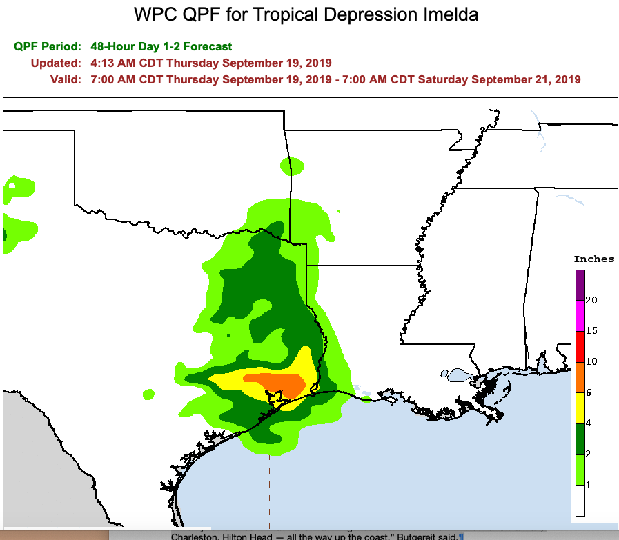
The 2019 Atlantic Hurricane Center has been challenging the ground rules for an insurance industry organization that dispatches pilots to take aerial photographs immediately after natural disasters. Usually, the Geospatial Intelligence Center doesn’t deploy aircraft or staff unless a Category …

Business News: CoreLogic, Betterview, Gallagher Bassett

CoreLogic Teams Up with Geospatial Insurance Consortium CoreLogic has integrated aerial imagery provided by the Geospatial Insurance Consortium into its underwriting platform, the Irvine, California-based analytics provider said in a press release. The GIC is a nonprofit organization sponsored by …

NICB Offers Inside Look at Geospatial Intelligence Center

Last year’s late season three hurricane wallop emphasized the growing use of aerial imagery to assist in assessing hard hit areas. Jim Schweitzer, senior vice president and chief operating officer for the National Insurance Crime Bureau, spoke with Claims Journal …