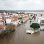
New computer simulations by government scientists show that hurricane storm surges in the Chesapeake Bay could get dramatically worse than the flooding caused by Tropical Storm Isabel in 2003.
Under some conditions, the researchers found, a Category 4 hurricane landing in the Carolinas could produce storm surges as high as 18 or 20 feet in Baltimore at high tide. That’s at least 10 feet above Isabel’s high-water mark.
The government used the latest version of its computerized SLOSH model to predict the surge. The name is an acronym for “Sea, Lake and Overland Surges from Hurricanes,” produced by the National Weather Service and the National Hurricane Center.
According to the projections, 18-foot storm surges are possible along the shoreline of Baltimore County, where Isabel did the most damage. Parts of Harford and Anne Arundel counties are just as vulnerable.
“I guess I’m a little surprised the values are as high as they are,” said Wilson Shaffer, chief of the National Weather Service evaluation branch in Silver Spring and a leader of the project.
Shaffer said the precise combinations of tide, storm strength, track, size and forward seed needed to generate an 18-foot storm surge on the bay are rare but “within the realm of possibility.”
Emergency managers, eager to avoid being unprepared for a catastrophe like Hurricane Katrina, are taking note of the predictions.
“A 20-some-foot storm surge up the bay is not something we want to take lightly,” said Robert Ward, all-hazards planner for the Maryland Emergency Management Agency. The new simulations are “a useful planning tool for us that we are going to take seriously.”
The agency is working with the U.S. Army Corps of Engineers and local officials to turn the simulation data into updated maps for emergency planning. The new maps will show how much farther inland flooding could stretch under the proper conditions.
“We have to make sure, as emergency managers, that we understand where those areas are, and provide adequate warning to those residents,” Ward said.
Shaffer is scheduled to present his findings to state emergency managers and demonstrate the SLOSH model software this week at MEMA headquarters in Reisterstown.
Lt. Mark Demski of Baltimore County’s Fire Department and its office of Homeland Security Management acknowledged that emergency managers failed to predict the extent of surging with Isabel, which made landfall as a Category 2 storm.
“We are involving a lot more people in this SLOSH training … so we can be better prepared for these situations,” Demski said.
Shaffer said the SLOSH simulation study was expanded because the previous model, in 2000, did not indicate the extent of the storm surge during Isabel. In the most recent study, scientists ran 50,000 storm simulations over 18 months.
“Isabel surprised us,” said MEMA spokesman Edward J. McDonough. “When Hurricane Isabel hit, the storm surge was significantly higher than all the forecast models forecasted. That was the genesis of updating the SLOSH model.”
The new data increased the “maximum envelopes of water” expected with storms of increasing strength.
The worst outcomes emerged from scenarios in which storms made landfall in the Carolinas at Category 4 and produced a storm surge arriving with high tide in the Chesapeake.
The resulting map shows the worst flooding that could be expected, and where, under such conditions.
Beyond the 18-foot surges in Baltimore, such a storm could generate floods of 14 to 16 feet on the shores of Kent, Queen Anne’s and southern Anne Arundel counties.
According to the simulations, even Category 3 storms could produce 13-foot storm surges in Baltimore, 15 feet in the South River and in Cecil County, and 18 feet at the mouth of the Gunpowder River.
David Manning, warning coordination meteorologist for the National Weather Service in Sterling, Va., said the findings delivered a clear message.
“Isabel was not the strongest hurricane that we could see,” he said. “The new study, with all its simulations, is new knowledge. And knowledge is power to those who need to make plans about the eventuality of another tropical cyclone affecting the area.”
___
Was this article valuable?
Here are more articles you may enjoy.

 UBS Top Executives to Appear at Senate Hearing on Credit Suisse Nazi Accounts
  These Five Technologies Increase The Risk of Cyber Claims
  Uber Jury Awards $8.5 Million Damages in Sexual Assault Case
  Portugal Rolls Out $2.9 Billion Aid as Deadly Flooding Spreads