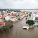
As of 8:00 this morning Hurricane Charley was passing over Western Cuba, and the National Hurricane Center in Miami puts the storm on a track to strike Central Florida by tomorrow morning.
Residents (and their insurers) in Charley’s potential path won’t be caught unawares, as numerous warnings and advisory bulletins have gone out (see related articles in Southeast section). The NHC’s three-day forecast indicates that Charley will cross Florida and continue up the east Coast of the U.S., striking the Carolina’s and Virginia by Saturday.
The NHC is maintaining a hurricane watch for the Florida Keys from Dry Tortugas to Ocean Reef including Florida Bay and on the West Coast of Florida from Flamingo to Anna Maria Island. “Charley is moving toward the west-northwest near 15 mph. – 23 km/hr. A turn toward the northwest is expected during the next 24 hours,” said the bulletin.
It also noted that “data from an air force reserve unit reconnaissance aircraft indicate that Charley has strengthened…and maximum sustained winds are now near 85 mph. – 135 km/hr. with higher gusts. Conditions appear to be favorable for continued intensification. Hurricane force winds extend outward up to 30 miles… 45 km. from the center…and tropical storm force winds extend outward up to 115 miles…185 km. minimum central pressure just reported by a reconnaissance plane was 989 mb…29.20 inches.”
Was this article valuable?
Here are more articles you may enjoy.

 China Bans Hidden Car Door Handles in World-First Safety Policy
  Founder of Auto Parts Maker Charged With Fraud That Wiped Out Billions
  Portugal Rolls Out $2.9 Billion Aid as Deadly Flooding Spreads
  Cape Cod Faces Highest Snow Risk as New Coastal Storm Forms