Catastrophe risk modeling firm AIR Worldwide described the storm, which struck Southern England and Wales last Friday night, November 13, as the “strongest storm of the season.”
Winds gusting up to 160 kilometers per hour (100 mph) were recorded on the Isle of Wight; 96 km/h (60 mph) gusts were recorded in Southampton and as far inland as parts of London. Strong winds and heavy rain continued through most of Saturday.
Some 60 buildings in the town of Lowestoft in Suffolk were damaged by what is thought to have been a mini-tornado. “Roof tiles were ripped from homes and chimneys toppled; downed trees damaged cars and branches littered roadways across much of southern England,” stated Dr. Gerhard Zuba, principal scientist, AIR Worldwide. In Dorset, the roof of a parking structure was blown off.
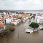
The Environment Agency issued 35 flood warnings and nearly 100 flood watches across England and Wales. However, the severe and widespread coastal flooding that had been forecast for Dorset, Hampshire and West Sussex fortunately failed to materialize.
“The storm resulted from a collection of gales that merged into a low-pressure system southwest of Britain and spanned most of the North Atlantic Ocean,” Dr. Zuba continued. “It followed a similar track to winter storm Oratia, which produced widespread flooding and damage in the region in October 2000.”
AIR pointed out that meteorologists said that while the weekend’s storm was “the worst to affect England so far this year, it was not particularly unusual for an autumnal storm—and indeed it brought welcome relief to areas that had been suffering from two months of near-drought conditions.”
Dr. Zuba commented, “Periods of heavy rain are forecast to continue through the week. Accumulations of 30 to 50mm (1 to 2 inches) are forecast to fall on already saturated soils in parts of Wales and southwest England beginning on Wednesday and the wet and windy conditions are expected to move north into northwest England and Scotland.”
AIR said the UK’s weather service, the Met Office “is forecasting gale force winds gusting to 96 km/h (60 mph) for the period Wednesday to Friday, accompanied by rainfall accumulations of up to 100mm (4 inches) over higher elevations.”
AIR also noted that it “models the effects of wind, coastal storm surge, and inland river flooding in Great Britain; however, after analyzing the available wind speed and precipitation data from this weekend’s storm, AIR does not expect significant insured losses. AIR is continuing to monitor the situation and will issue updates if warranted by events.
Source: Air Worldwide – www.air-worldwide.com
Was this article valuable?
Here are more articles you may enjoy.

 Portugal Rolls Out $2.9 Billion Aid as Deadly Flooding Spreads
  Tesla Sued Over Crash That Trapped, Killed Massachusetts Driver
  Berkshire Utility Presses Wildfire Appeal With Billions at Stake
  UBS Top Executives to Appear at Senate Hearing on Credit Suisse Nazi Accounts