Lately, the jet stream isn’t playing by the rules. Scientists say that big river of air high above Earth that dictates much of the weather for the Northern Hemisphere has been unusually erratic the past few years.
They blame it for everything from snowstorms in May to the path of Superstorm Sandy.

And last week, it was responsible for downpours that led to historic floods in Alberta, Canada, as well as record-breaking heat in parts of Alaska, experts say. The town of McGrath, Alaska, hit 94. Just a few weeks earlier, the same spot was 15 degrees.
The current heat wave in the Northeast is also linked. “While it’s not unusual to have a heat wave in the east in June, it is part of the anomalous jet stream pattern that was responsible for the flooding in Alberta,” Rutgers University climate scientist Jennifer Francis said Tuesday in an email.

The jet stream usually rushes rapidly from west to east in a mostly straight direction. But lately it’s been wobbling and weaving like a drunken driver, wreaking havoc as it goes. The more the jet stream undulates north and south, the more changeable and extreme the weather.
It’s a relatively new phenomenon that scientists are still trying to understand. Some say it’s related to global warming; others say it’s not.
In May, there was upside-down weather: Early California wildfires fueled by heat contrasted with more than a foot of snow in Minnesota. Seattle was the hottest spot in the nation one day, and Maine and Edmonton, Canada, were warmer than Miami and Phoenix.
Consider these unusual occurrences over the past few years:
- The winter of 2011-12 seemed to disappear, with little snow and record warmth in March. That was followed by the winter of 2012-13 when nor’easters seemed to queue up to strike the same coastal areas repeatedly.
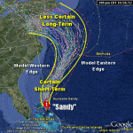
- Superstorm Sandy took an odd left turn in October from the Atlantic straight into New Jersey, something that happens once every 700 years or so.
- One 12-month period had a record number of tornadoes. That was followed by 12 months that set a record for lack of tornadoes.
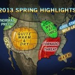
And here is what federal weather officials call a “spring paradox”: The U.S. had both an unusually large area of snow cover in March and April and a near-record low area of snow cover in May. The entire Northern Hemisphere had record snow coverage area in December but the third lowest snow extent for May.
“I’ve been doing meteorology for 30 years and the jet stream the last three years has done stuff I’ve never seen,” said Jeff Masters, meteorology director at the private service Weather Underground. “The fact that the jet stream is unusual could be an indicator of something. I’m not saying we know what it is.”
Rutgers’ Francis is in the camp that thinks climate change is probably playing a role in this.
“It’s been just a crazy fall and winter and spring all along, following a very abnormal sea ice condition in the Arctic,” Francis said, noting that last year set a record low for summer sea ice in the Arctic. “It’s possible what we’re seeing in this unusual weather is all connected.”
Other scientists don’t make the sea ice and global warming connections that Francis does. They see random weather or long-term cycles at work. And even more scientists are taking a wait-and-see approach about this latest theory. It’s far from a scientific consensus, but it is something that is being studied more often and getting a lot of scientific buzz.
“There are some viable hypotheses,” Stanford University climate scientist Noah Diffenbaugh said. “We’re going to need more evidence to fully test those hypotheses.”
The jet stream, or more precisely the polar jet stream, is the one that affects the Northern Hemisphere. It dips down from Alaska, across the United States or Canada, then across the Atlantic and over Europe and “has everything to do with the weather we experience,” Francis said.
It all starts with the difference between cold temperatures in the Arctic and warmer temperatures in the mid-latitudes, she explained. The bigger the temperature difference, the stronger the jet stream, the faster it moves and the straighter it flows. But as the northern polar regions warm two to three times faster than the rest of the world, augmented by unprecedented melting of Arctic sea ice and loss in snow cover, the temperature difference shrinks. Then the jet stream slows and undulates more.
The jet stream is about 14 percent slower in the fall now than in the 1990s, according to a recent study by Francis. And when it slows, it moves north-south instead of east-west, bringing more unusual weather, creating blocking patterns and cutoff lows that are associated with weird weather, the Rutgers scientist said.
Mike Halpert, the deputy director of NOAA’s Climate Prediction Center, said that recently the jet stream seems to create weather patterns that get stuck, making dry spells into droughts and hot days into heat waves.
Take the past two winters. They were as different as can be, but both had unusual jet stream activity. Normally, the jet stream plunges southwest from western Washington state, sloping across to Alabama. Then it curves slightly out to sea around the Outer Banks, a swoop that’s generally straight without dramatic bends.
During the mostly snowless winter of 2011-12 and the record warm March 2012, the jet stream instead formed a giant upside-down U, curving dramatically in the opposite direction. That trapped warm air over much of the Eastern U.S. A year later the jet stream was again unusual, this time with a sharp U-turn north. This trapped colder and snowier weather in places like Chicago and caused nor’easters in New England, Francis said.
But for true extremes, nothing beats tornadoes.
In 2011, the United States was hit over and over by killer twisters. From June 2010 to May 2011 the U.S. had a record number of substantial tornadoes, totaling 1,050. Then just a year later came a record tornado drought. From May 2012 to April 2013 there were only 217 tornadoes – 30 fewer than the old record, said Harold Brooks, a meteorologist at the National Severe Storms Laboratory. Brooks said both examples were related to unusual jet stream patterns.
Last fall, a dip in the jet stream over the United States and northward bulge of high pressure combined to pull Superstorm Sandy almost due west into New Jersey, Francis said. That track is so rare and nearly unprecedented that computer models indicate it would happen only once every 714 years, according to a new study by NASA and Columbia University scientists.
“Everyone would agree that we are in a pattern” of extremes, NOAA research meteorologist Martin Hoerling said. “We don’t know how long it will stay in this pattern.”
Was this article valuable?
Here are more articles you may enjoy.

 Canceled FEMA Review Council Vote Leaves Flood Insurance Reforms in Limbo
  Cape Cod Faces Highest Snow Risk as New Coastal Storm Forms
  Uber Jury Awards $8.5 Million Damages in Sexual Assault Case
  Founder of Auto Parts Maker Charged With Fraud That Wiped Out Billions